Originally Posted by
yeah_na_missed

Hi Happy Jack. Is that the NZTopoMaps app (by Atlogis) or NZTopo50 offline app where you pay for Nth and Sth Islands separately?
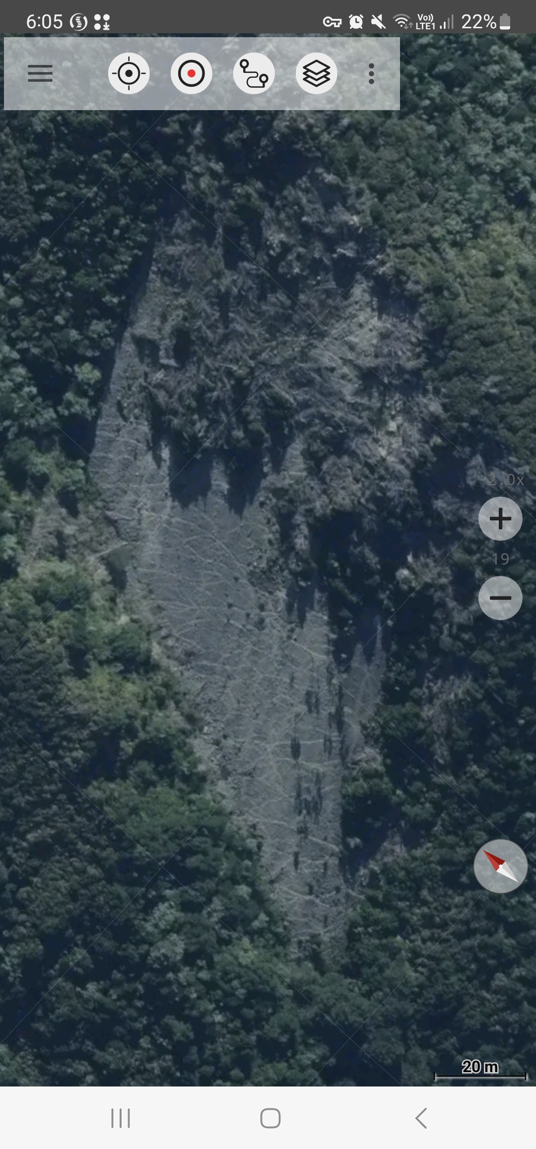
Prob should have said this is on the paid/pro version of NZTopoMaps.
I tried the NZ Topo50 Offline maps, but found the detail wasn't high enough. The guy said that's elated to the size of the map/aerial phot file. I asked if you could just load small areas of higher detail, and he said he's looking into it, so I ended up going pro on NZTopoMaps.