

 14Likes
 LinkBack URL
 About LinkBacks
Massive country. I walked from Ossify Creek, up Commotion Creek into the Browning Range, around headwaters of Franklin Creek to Howe Crags down Nosegay Spur around and back up around onto Browning Range, along to Turnbull Pass and to Mt Lycia, then back down to Blossom Spur and to the mouth of Accident Creek where our base camp was.
Did that in a day, but it was a massive day, and I was fit. Got home to camp well after dark - although I did sit up in the tops above the Cramp Creek basin waiting for a stag to show himself and headed back to camp in the dark. Some gnarly country around Mount Franklin. You have to drop altitude and climb back up several times to negotiate bluffs and canyons/huge gutters. I wasn't confident trying to go over Mt Franklin, didn't know if you could, and it was foggy at times.
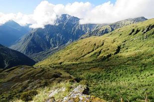
I was lucky and managed to avoid getting bluffed, especially after seeing the country from above on the flight out. Generally the tops are very clean and good travelling. The worst thing I found was the short grass and mountain herb steep faces, they're slippery as!
Absolutely stunning hunting country, and well worth a trip even if you don't traverse all the country you would like to.
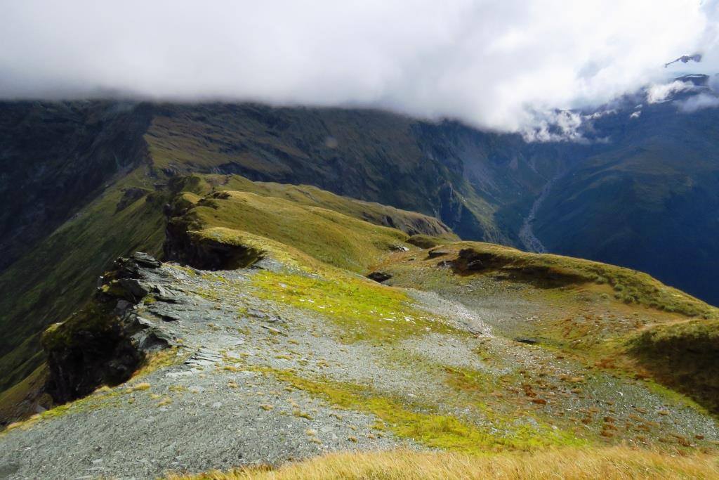
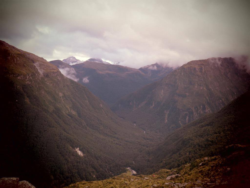
Looking across to Mt Franklin in background - note wallow...
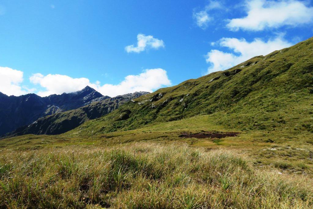
Heading towards Turnbull Pass - Cache Creek out to the right
Ossify Valley on left, looking back towards the dark faces of Accident Creek
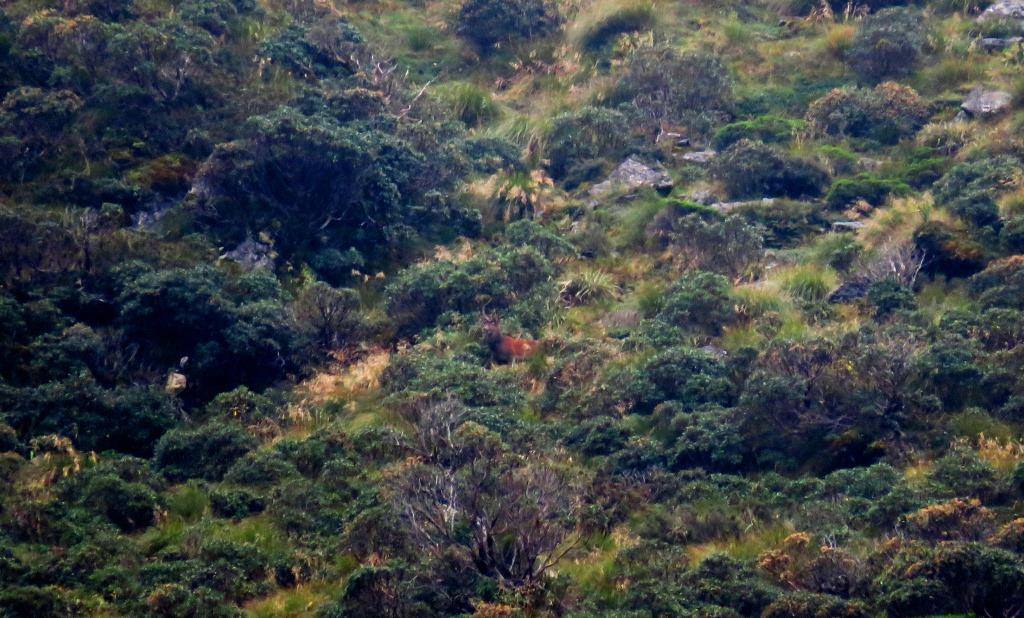
Some nice animals in there
Looking down from the true right side of Ossify, towards Turnbull. You can see the Pass in the distance (centre-left -ish)
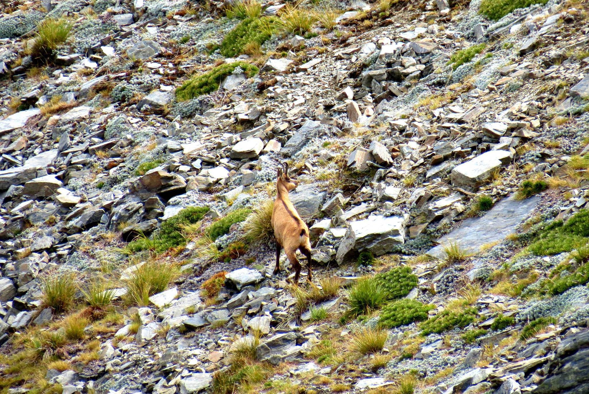
Plenty of these up there. Did see a one horned Doe who's horn would have cracked 11 inches easy, if not 12
Welcome guest, is this your first visit? Create Account now to join.
Welcome to the NZ Hunting and Shooting Forums.
Search Forums


User Tag List
+ Reply to Thread
Results 1 to 6 of 6
Hybrid View
-
01-02-2019, 09:28 AM #1Member


- Join Date
- Apr 2012
- Location
- Southland/Otago
- Posts
- 3,731
Last edited by JoshC; 01-02-2019 at 09:46 AM.
I'm drawn to the mountains and the bush, it's where life is clear, where the world makes the most sense.


 Reply With Quote
Similar Threads
-
Browning x bolts: hells canyon long range vs long range hunter
By Toby132 in forum Firearms, Optics and AccessoriesReplies: 8Last Post: 28-06-2019, 10:15 AM -
Photos - 5 Days in South Westland (correct photos)
By HandR in forum The MagazineReplies: 8Last Post: 23-01-2018, 05:30 PM -
Photos from 5 Days in South Westland
By HandR in forum The MagazineReplies: 4Last Post: 19-01-2018, 11:12 AM -
Film 15: South Westland
By gimp in forum The MagazineReplies: 22Last Post: 09-02-2015, 09:39 PM
Tags for this Thread
 Posting Permissions
- You may not post new threads
- You may not post replies
- You may not post attachments
- You may not edit your posts
Welcome to NZ Hunting and Shooting Forums! We see you're new here, or arn't logged in. Create an account, and Login for full access including our FREE BUY and SELL section Register NOW!!
All times are GMT +13. The time now is 07:12 AM.

Bookmarks