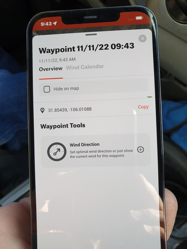
Just type it into google, in the format as shown.
its latitude and longitude Co-ordinates. First number is latitude second number longitude.
https://www.google.com/maps/place/31...1088?entry=ttu
Positive Latitude is Northern hemisphere, the higher the number the further north. Then negative is south, the higher the negative the further south.
Same with Second number. Is east and west. Positive number is east from their datum point, and negative is west.
Last edited by Nugget connaisseur; 06-10-2023 at 10:46 AM.
With the global datum on the equator south of Ghana (i didn't know that until looking just now)
oh sorry google maps,
and it will convert it to degrees
and here you see a classic fcukup in the making...you have grid references but no indication (that I can see) of which scale/map series/type of references/format, they relate to
google earth is really handy to use BUT if you want to use it with your hand held gps,you have to make the two devises talk in same format... or will give two different sets of numbers for same spot on ground.....or different spot on ground for each set of numbers depending on which way you look at it.... simply explained....my Dannyb has treasure buried 100 paces north and 10 steps east from his back door,but if finnwolf paced them out he would more than likely be off by a good amount as his shorter/more aged legs wont give same stride length.
75/15/10 black powder matters
Good point.
Very important to know what co ordinate system you are using. If comparing it to another.
Usually maps will tell you what their grid / datum is.
NZTM for NZ topo 50.
UTM i believe is the global co ordinates in the op photo.
Im used to working in site specific datums.
Linz has a handy conversion tool for different datums.
the way I got google earth to talk to my heldheld.... put mouse of google earth on my home,then kept changing the grid setting in my GPS untill the numbers it displayed were same as were seeing on screen/google earth...... then double checked with some of my waypoints saved into phone..eg looked at then in phone and moved mouse on google earth to their location and again made sure both sets of numbers were the same.
really good for that but shit if trying to give mate your grid reference unless you switch back again LOL.
75/15/10 black powder matters
It's degrees lat and longitude, in decimal form. A standard system.
That's the format of my "GPS Data" app on my iphone. Came in handy once when at a SxS event near Kuratau. Some guys we were with had a major crash with one really injured. Impossible for an ambulance to reach them out the back of a muddy farm. Called up and gave them the co-ords off the phone which the chopper guy was able to use.
The rescue choppers and RCC are able to translate any format given so as long as you can get a position out to them help should arrive.
Bookmarks