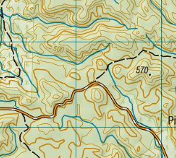
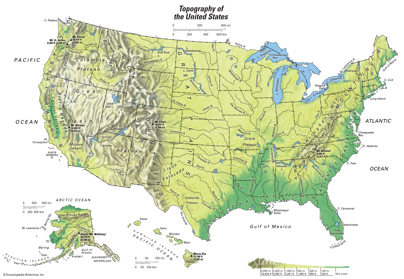
So i currently use NZ topo50 north island really good map and using it offline works awesome too. Now ive done some research online but the american topo are a bit different to my one. Can some point out what i should be looking for.
Welcome guest, is this your first visit? Create Account now to join.
Welcome to the NZ Hunting and Shooting Forums.
Search Forums
User Tag List
+ Reply to Thread
Results 1 to 15 of 16
Thread: Topo map tips?
-
08-01-2019, 09:06 PM #1Member

- Join Date
- Oct 2018
- Location
- North island
- Posts
- 50
Topo map tips?
-
-
08-01-2019, 09:15 PM #2Member

- Join Date
- Feb 2016
- Location
- Stewart island / canterbury
- Posts
- 9,193
What do you mean by looking for?
Your picture has a gravel road running West to south(orange white) 4x4 tracks branching off it. 570 is m above sea level. Blwpue lines are creeks indicating Valley floor. Contours should be 20m Darke line every 100. Forestry on eastern edge with 4wd track (skidder track or some prick with 35" muddies)
-
08-01-2019, 09:30 PM #3
Himmm American topo map

New Zealand topo map
Ok so let’s point out what you are looking for.....??????
Could you please maybe rephrase the question cheers It's all fun and games till Darthvader comes along
I respect your beliefs but don't impose them on me.
-
08-01-2019, 09:56 PM #4
-
08-01-2019, 09:58 PM #5Member

- Join Date
- Dec 2017
- Location
- Waikato
- Posts
- 752
The paper versions have a legend down the side that should help.
Thin orange lines denote 20m change in elevation and thick orange lines 100m.More meplat, more better.
-
08-01-2019, 11:10 PM #6Gone but not forgotten

- Join Date
- Apr 2017
- Location
- Hamilton
- Posts
- 4,129
I think he is wanting to know how to identify good hunting areas from the maps?
-
09-01-2019, 12:11 PM #7
If you go to the top bar and select overlays(looks like a pile of paper)select national imagrey that will give you satellite photo of the area your looking at, you'll be able to see clearings /slips etc
-
09-01-2019, 12:28 PM #8Member

- Join Date
- Apr 2018
- Posts
- 1
Is this the app your using?


Sent from my ALE-L02 using Tapatalk
-
09-01-2019, 12:39 PM #9Banned

- Join Date
- Mar 2016
- Location
- auckland
- Posts
- 2,453
Top effort there chaps based on the original post alone

-
09-01-2019, 01:09 PM #10
just to add the best way to understand and process how topo maps work is thru being out there and gaining experience. so take your map and compass your gps and plb and go for a hike , if you cant get out for a hunt go for a walk in one of the auckland ranges (hunua or waitaks whatever). i dont believe bush skill/sense and orienteering can be fully understood and learned thru reading or surfing the web.
just my opinion
-
09-01-2019, 01:15 PM #11Member

- Join Date
- May 2018
- Location
- Porirua
- Posts
- 1,342
I could add to what @scotty said, get an altimeter ant try following a contour line. Altimeters are very good for finding saddles and ridges in dense bush.
Remember the 7 “P”s; Pryor Preparation Prevents Piss Poor Performance.
-
09-01-2019, 01:20 PM #12Member

- Join Date
- Mar 2017
- Location
- Southland
- Posts
- 1,250
Aside from navigation, you could use your paper topo map as toilet paper (beware of paper cuts); as a giant cigar; as a blanket; or as a bib while you're snacking, so you don't get crumbs on your brand new hunting jacket.

Have you looked at the map 'key/legend'? There will always be one on the paper versions, and I'm pretty sure there's one on New Zealand Topographic Map - NZ Topo Map...it'll help you identify any map features which may be unique to our topography.
-
09-01-2019, 05:43 PM #13Member

- Join Date
- Oct 2018
- Location
- North island
- Posts
- 50
I’ll rephrase that I was meaning hinting areas on a topo to look out for photo was just an example of a random area. Cheers
-
09-01-2019, 06:18 PM #14
so you understand the topomap format and whats a headgut or a waterfall and so on etc ? as mentioned above use the aerial layer to get a birdseye view of slips and clearings and wotnot transfer those onto your topo and go have a look deer have preferences for certain food and and will roam randomly to get it they do need to drink .when they are cold they want to warm up and when they are hot they want to cool down. what looks like a good spot may or may not be you need to put boots in their and look..... dont expect to look at a topo mark a spot go out and tip one over .... unless your really lucky you might have to hit a spot over and over again till you get the time and season right.... or if its shit flag it and try somewhere else.
im sure ive missed something and if i got something wrong i will be corrected
-
09-01-2019, 08:21 PM #15Member

- Join Date
- Dec 2017
- Location
- Waikato
- Posts
- 752
Similar Threads
-
Topo GPS
By MB in forum Gear and EquipmentReplies: 0Last Post: 04-07-2017, 02:47 PM -
topo maps
By Dynastar27 in forum Gear and EquipmentReplies: 29Last Post: 06-04-2014, 11:15 PM -
Sat nav with topo
By Pengy in forum Gear and EquipmentReplies: 0Last Post: 10-11-2013, 11:41 AM -
GPS Topo Map
By lost in forum Gear and EquipmentReplies: 21Last Post: 27-07-2013, 08:06 PM
Tags for this Thread
Welcome to NZ Hunting and Shooting Forums! We see you're new here, or arn't logged in. Create an account, and Login for full access including our FREE BUY and SELL section Register NOW!!


 12Likes
 LinkBack URL
 About LinkBacks


 Reply With Quote


Bookmarks