
 20Likes
 LinkBack URL
 About LinkBacks
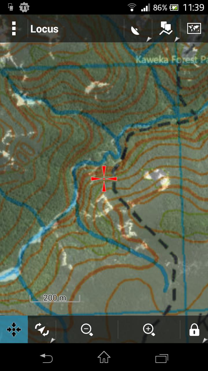
Some other apps to check out: Locus, Back Country Navigator, Maverick. I use Locus Pro myself, has offline maps, topo shading and map overlays (eg overlay Sat map on topo) as well as every other feature you'd need. Developer is responsive too, I requested the NZtopo maps to be added as one of the online options and he added it.Originally Posted by R93

Full NZTopo50 maps are available for free (my favorite price) I just use the PC program "Mobile Atlas Creator" to make the offline maps I want - NZTopo50, sat, street or whatever. Copy the file to my phone - easy as.
Heres an example of Topo map with Sat overlay (you can adjust the transparancy to suit)
Welcome guest, is this your first visit? Create Account now to join.
Welcome to the NZ Hunting and Shooting Forums.
Search Forums


User Tag List
Results 1 to 15 of 78
Thread: Garmin Monterra GPS
Threaded View
-
16-12-2013, 11:27 AM #11Muppets Inc.


- Join Date
- Jun 2012
- Location
- Napier
- Posts
- 303
Last edited by SIKAHUNTER; 16-12-2013 at 11:49 AM.
R93 likes this.


 Reply With Quote
Similar Threads
-
garmin 62s
By nork1122 in forum Gear and EquipmentReplies: 9Last Post: 15-07-2013, 04:08 PM -
garmin 62s, which sd card?
By foxhound in forum Gear and EquipmentReplies: 0Last Post: 09-03-2013, 06:19 PM
Tags for this Thread
- 260,
- 300,
- 5000,
- accurate,
- adventure,
- app,
- atlas,
- ballistics,
- bucks,
- buy,
- camera,
- canopy,
- case,
- cheap,
- coast,
- day trip,
- deer,
- device,
- farmer,
- garmin,
- gear,
- gps,
- handheld,
- information,
- iphone,
- kawekas,
- legend,
- loads,
- lost,
- maps,
- offline,
- pack,
- packs,
- pants,
- permits,
- phone,
- plb,
- r93,
- radio,
- rangefinder,
- ranger,
- ranges,
- receiver,
- rino,
- rust,
- satellite,
- sony,
- south island,
- tahr hunting,
- tents,
- test,
- top,
- topo maps,
- trip,
- turn,
- usa,
- water proof,
- waterproof,
- west coast
 Posting Permissions
- You may not post new threads
- You may not post replies
- You may not post attachments
- You may not edit your posts
Welcome to NZ Hunting and Shooting Forums! We see you're new here, or arn't logged in. Create an account, and Login for full access including our FREE BUY and SELL section Register NOW!!
All times are GMT +13. The time now is 10:32 AM.

Bookmarks