

 14Likes
 LinkBack URL
 About LinkBacks
Anyone had trouble with this ap?have been using for couple of years now but while down Clements mill rd on the weekend it was next to useless..maps wouldnt show up with any real detail if at all.thoughts?
Welcome guest, is this your first visit? Create Account now to join.
Welcome to the NZ Hunting and Shooting Forums.
Search Forums


User Tag List
+ Reply to Thread
Results 1 to 15 of 24
Thread: Nz topo ap issues
-
06-10-2024, 11:42 AM #1Member

- Join Date
- Jul 2013
- Location
- Waikato
- Posts
- 2,612
Nz topo ap issues
-
-
06-10-2024, 11:43 AM #2Member
- Join Date
- Jul 2013
- Location
- Waikato
- Posts
- 2,612
Working fine now I’m home again.wtf?
-
06-10-2024, 12:39 PM #3Member
- Join Date
- Jan 2019
- Location
- South Canterbury
- Posts
- 1,663
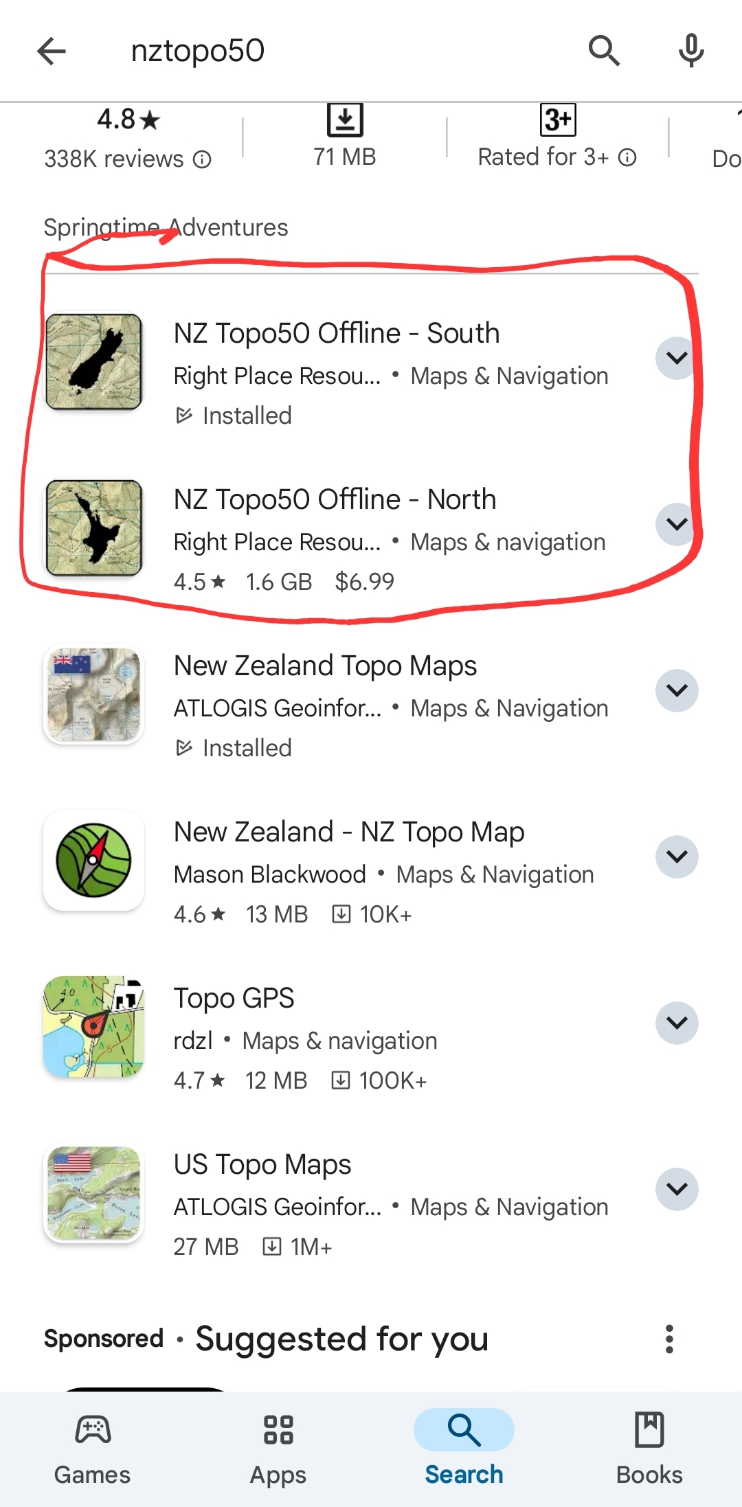
I've always found that one shit to use. Does it need data to refresh the maps? Better off with the $7 offline NZTopo50 apps.
Another good site if you have data available is https://basemaps.linz.govt.nz/@-42.3...9589,z4.30,p1?
-
06-10-2024, 01:03 PM #4Member


- Join Date
- Sep 2013
- Location
- Tasman
- Posts
- 7,425
Free or subscription version?
Experience. What you get just after you needed it.
-
06-10-2024, 01:25 PM #5Member

- Join Date
- Apr 2023
- Location
- North King Country
- Posts
- 415
A seconder for this one. works well, can leave a snail trail to track back to. well worth $7 Originally Posted by RUMPY
 Ducksnchips likes this.
-
06-10-2024, 02:02 PM #6Member
- Join Date
- Jul 2013
- Location
- Waikato
- Posts
- 2,612
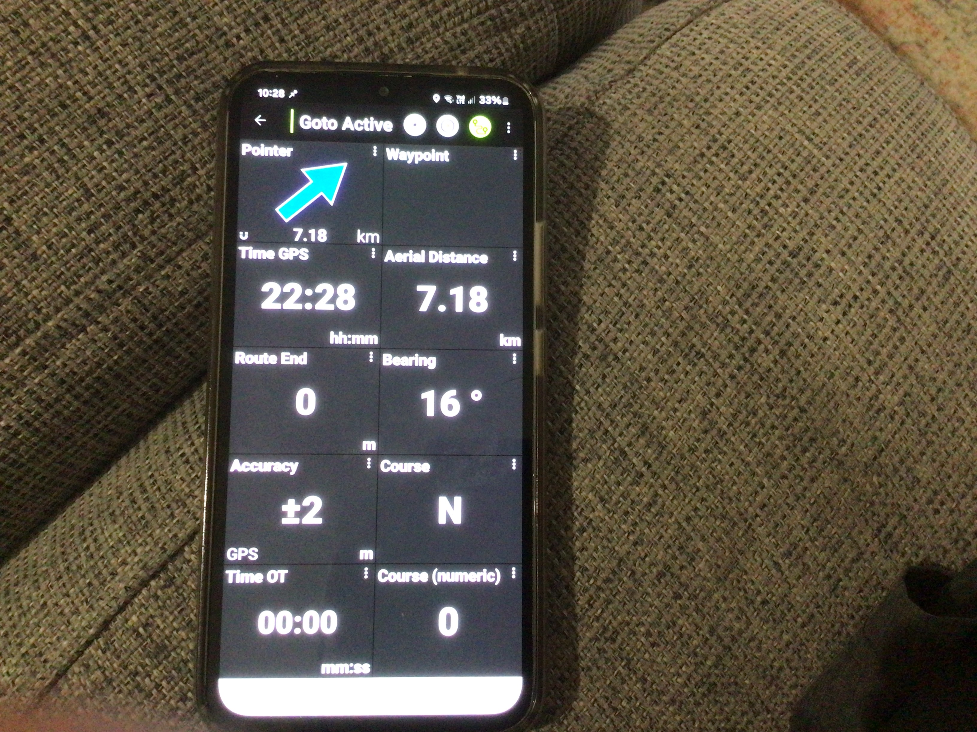
Just bought the one you guys mentioned but can’t find a pointer function to show which direction you need to go to get to a waypoint ?am I missing something?
-
06-10-2024, 02:20 PM #7Caretaker

- Join Date
- May 2012
- Location
- Rolleston, Canterbury
- Posts
- 5,199
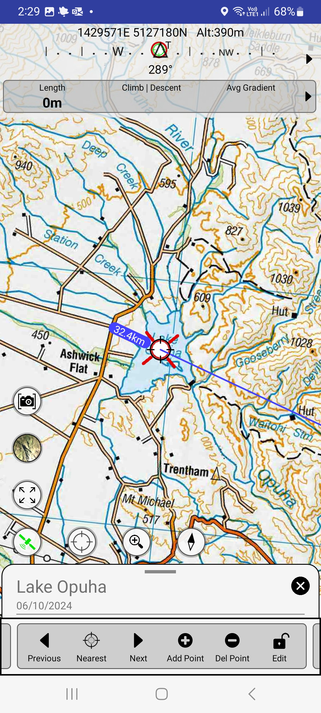
Go to the settings turn on “show compass overlay”
Then turn off “use GPS course instead of compass”
Also turn on “allow free rotation”
When you have a waypoint selected it will show as a red circle in the top compass bearing. Rotate the phone until the red circle is in the middle of the screen at the topTimC likes this.
-
06-10-2024, 02:34 PM #8Member
- Join Date
- Jan 2019
- Location
- South Canterbury
- Posts
- 1,663
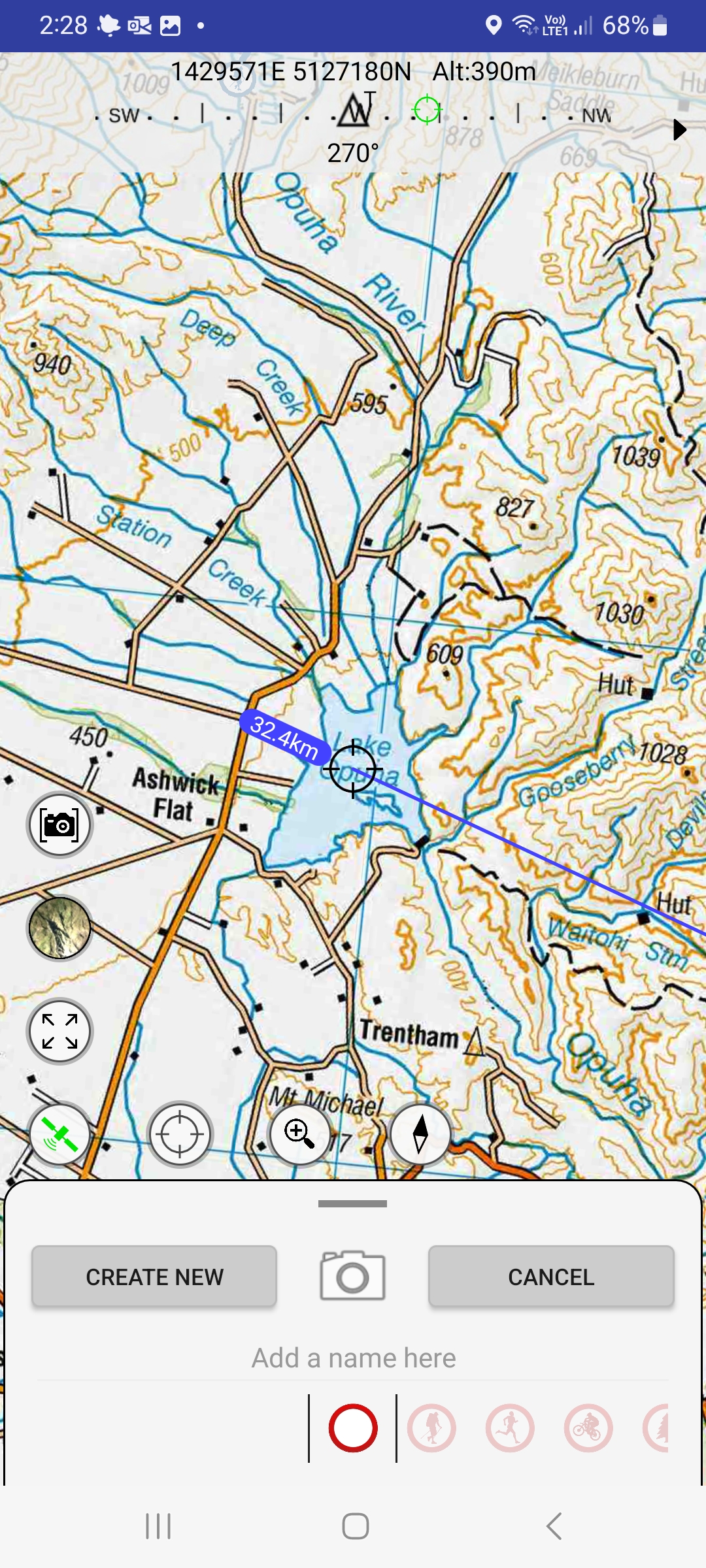
If you know the point you want to get to you can put target on that point and create a waypoint. Once the waypoint is created it will show as the red circle on top compass bar like @stug said above.

-
06-10-2024, 02:38 PM #9Member
- Join Date
- Jan 2019
- Location
- Paremata
- Posts
- 827
I use topo50 too. One thing I would say is to check it doesn't need updating before heading out to an area with no cellphone access.
Gibo likes this.Pack out heavy
-
06-10-2024, 10:24 PM #10Member
- Join Date
- Jul 2013
- Location
- Waikato
- Posts
- 2,612
Does it tell you it needs an update?otherwise how do I update?confirmed technophobe here..
-
06-10-2024, 10:25 PM #11Member
- Join Date
- Jul 2013
- Location
- Waikato
- Posts
- 2,612
Really like the topo50 when it’s working.first time I have had a reall issue with it to be honest.
-
06-10-2024, 10:29 PM #12Member
- Join Date
- Jul 2013
- Location
- Waikato
- Posts
- 2,612
So no big arrow showing me which way to go??like this..bugger Originally Posted by RUMPY
-
06-10-2024, 10:36 PM #13Member

- Join Date
- Jan 2016
- Location
- Cambridge
- Posts
- 1,708
Never had a problem with the one bomb uses.
Just need to make sure you look at the area you are going to first. It's not permernantly stored on your phone like the other app.erniec likes this.
-
06-10-2024, 10:37 PM #14Member
- Join Date
- Jul 2013
- Location
- Waikato
- Posts
- 2,612
Ok have changed over the settings,looks like it should work,only really be a backup in case the other app has issues again hopefully.
-
07-10-2024, 09:04 AM #15Member
- Join Date
- Feb 2016
- Location
- Marlborough
- Posts
- 1,181
As stated on another thread I’ve tried various mapping apps including the Atlogis Topo NZ one. The two best that I used are NZ Topo 50 and Ihike. I use NZ Topo 50 mostly but also Memory-Map as that’s what’s on home computer. Either one is good for downloading POI and animals shot waypoints for DOC. Still carry a Garmin 62 backup at times, pissy little screen compared to phone though.


 Reply With Quote
Similar Threads
-
Best Topo/GPS app
By tanqueray in forum HuntingReplies: 33Last Post: 29-04-2022, 04:32 PM -
Topo GPS
By MB in forum Gear and EquipmentReplies: 0Last Post: 04-07-2017, 02:47 PM -
Sat nav with topo
By Pengy in forum Gear and EquipmentReplies: 0Last Post: 10-11-2013, 11:41 AM -
GPS Topo Map
By lost in forum Gear and EquipmentReplies: 21Last Post: 27-07-2013, 08:06 PM
Tags for this Thread
 Posting Permissions
- You may not post new threads
- You may not post replies
- You may not post attachments
- You may not edit your posts
Welcome to NZ Hunting and Shooting Forums! We see you're new here, or arn't logged in. Create an account, and Login for full access including our FREE BUY and SELL section Register NOW!!
All times are GMT +13. The time now is 05:25 PM.

Bookmarks