
 104Likes
 LinkBack URL
 About LinkBacks
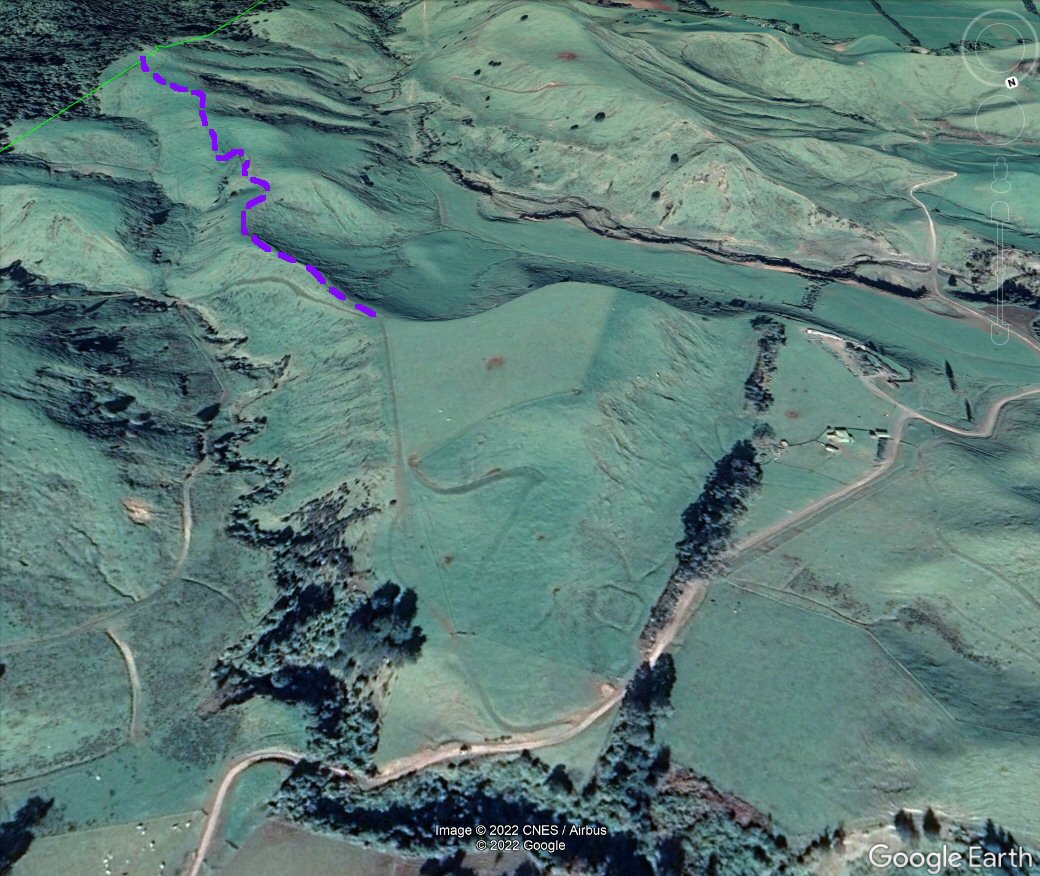
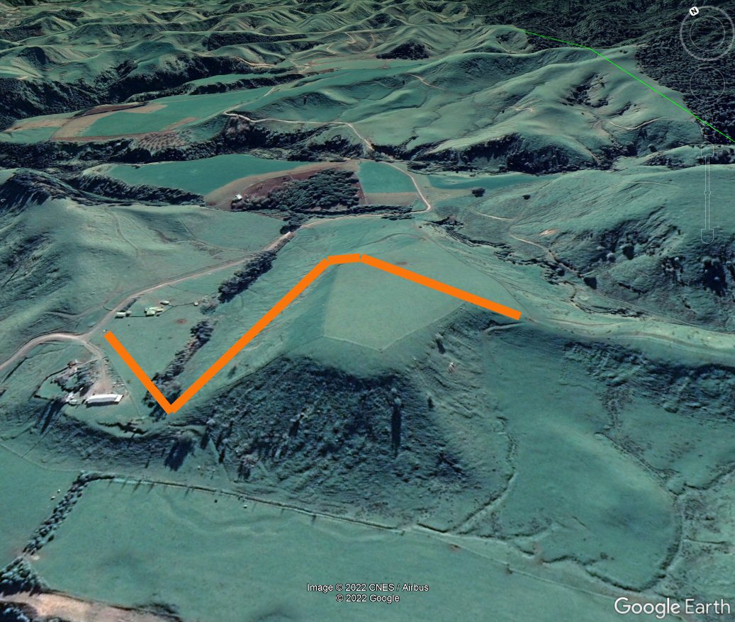
Here is a cut & paste from Google Earth that gives a better idea of where the existing road cuts up to attain the ridgeline.
An alternative to reach the upper paddock and rejoin the remaining road and current walking route (purple) could perhaps - judging from the apparent gradient looking from the other direction - follow the line of one of the existing farm tracks that have their point of access from further up Opawe road?
Welcome guest, is this your first visit? Create Account now to join.
Welcome to the NZ Hunting and Shooting Forums.
Search Forums


User Tag List
Results 1 to 15 of 54
Thread: Could be bad news
Threaded View
-
31-05-2022, 12:52 PM #24Member


- Join Date
- May 2012
- Location
- Porirua
- Posts
- 1,032
Last edited by Puffin; 31-05-2022 at 01:11 PM.


 Reply With Quote
Similar Threads
-
AW,S NEWS
By gsp follower in forum Game Bird HuntingReplies: 24Last Post: 02-12-2013, 09:22 PM
Tags for this Thread
 Posting Permissions
- You may not post new threads
- You may not post replies
- You may not post attachments
- You may not edit your posts
Welcome to NZ Hunting and Shooting Forums! We see you're new here, or arn't logged in. Create an account, and Login for full access including our FREE BUY and SELL section Register NOW!!
All times are GMT +13. The time now is 03:10 AM.

Bookmarks