Welcome guest, is this your first visit? Create Account now to join.
Welcome to the NZ Hunting and Shooting Forums.
Search Forums
User Tag List
+ Reply to Thread
Results 16 to 30 of 34
Thread: Best Topo/GPS app
-
15-04-2022, 02:36 PM #16Member

- Join Date
- Mar 2013
- Location
- Palmerston North
- Posts
- 80
-
-
15-04-2022, 02:50 PM #17
-
15-04-2022, 02:53 PM #18
Top one
Shut up, get out & start pushing!
-
15-04-2022, 03:09 PM #19Member

- Join Date
- Dec 2011
- Location
- Southern Alps
- Posts
- 4,993
I use to use viewranger,very good.Now (outdooractive)=LINZ,Free off line,good map tracking and accurate.
-
15-04-2022, 03:49 PM #20Gone but not forgotten

- Join Date
- Apr 2017
- Location
- Hamilton
- Posts
- 4,129
-
15-04-2022, 08:14 PM #21Member

- Join Date
- Oct 2019
- Location
- Owaka
- Posts
- 267
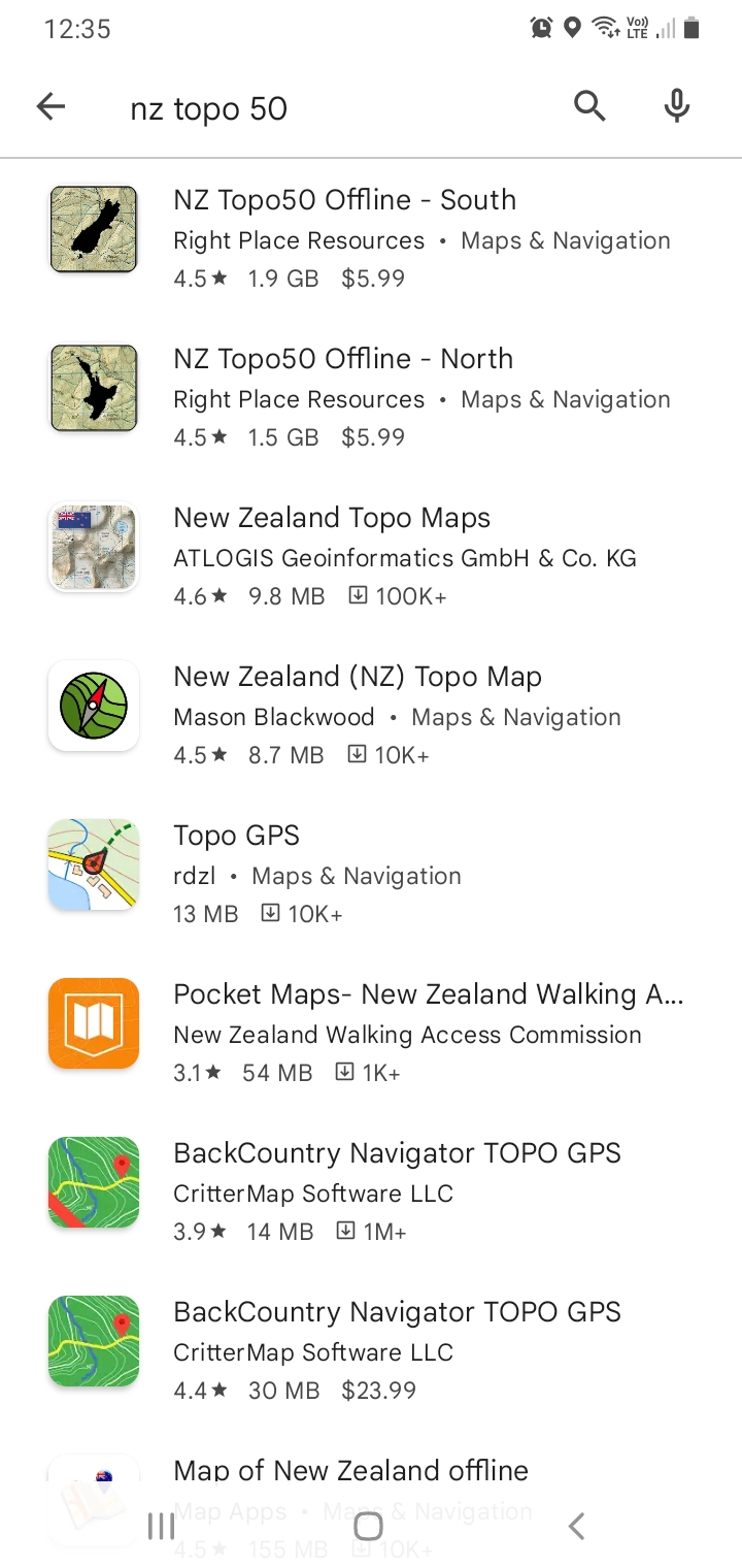
I use NZTopo 50 south. Its excellent. Works offline, Can switch between topo and satellite layers, plot and mark stuff, even has some of the ballot areas split into their blocks. I downloaded the north island when I was on a ram stud tour just for shits and giggles while we were driving around.
-
19-04-2022, 07:49 AM #22
Had a go with NZ Topo50 on a day tramp. It's good, certainly on the main map page. I like the arrows which show direction of travel and offline satellite images toggle. Hunting areas are shown. Not so keen on the recording of routes and searching waypoints. Couldn't find my route after I finished recording and the waypoints page is very confusing with literally every place in NZ listed. Wish I could delete that list. Overall, it's a great app, maybe I just need to spend more time using it.

-
19-04-2022, 08:03 AM #23
-
19-04-2022, 12:23 PM #24
-
19-04-2022, 02:35 PM #25Member

- Join Date
- Mar 2013
- Location
- Palmerston North
- Posts
- 80
-
19-04-2022, 03:02 PM #26
spent 6 weeks hunting sika in the roar 2021 using the 3rd one down uses bugger all power always being on logging position can use offline aswell just select an area and cache map, worked very well
has a gps62s and ended up selling it at the end of the roar never used it other then marking camp as a backup to the phone
-
19-04-2022, 04:24 PM #27
Steve the developer got back to me really quickly. It seems that you can't delete the preloaded waypoints, but you can hide them on the map via settings and as cbfb says, you can hide them on the search screen by tapping "user" so you will only see your own personal waypoints.
-
25-04-2022, 08:46 PM #28Gone but not forgotten

- Join Date
- Apr 2017
- Location
- Hamilton
- Posts
- 4,129
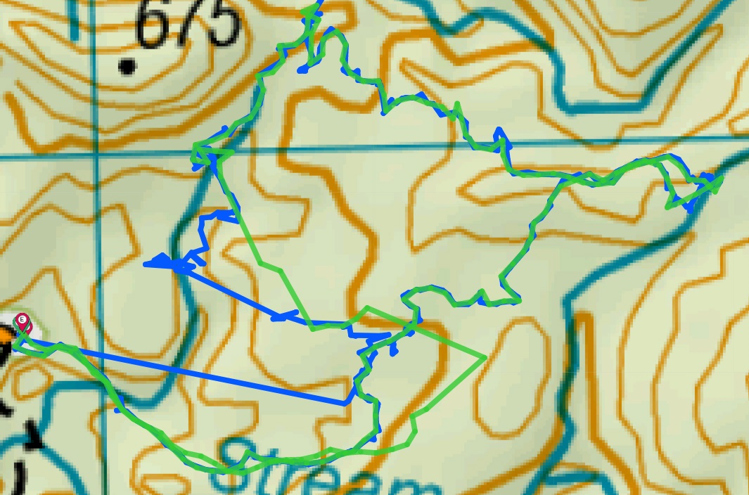
I used the NZ Topo50 app on my phone today for the first time. I haven't gone through the post-match analysis but I was impressed with how well it worked.
At one point it had us on the wrong side of a stream - but checking my GPS it was the same so a map issue not the app.
Then later on it wasn't giving me a position - but checking the GPS it had lost satellite reception too, so onece again not the fault of the app.
Where the app definitely beat the GPS was showing which direction you are facing.
-
26-04-2022, 06:46 PM #29Gone but not forgotten

- Join Date
- Apr 2017
- Location
- Hamilton
- Posts
- 4,129
-
29-04-2022, 02:58 PM #30Member

- Join Date
- Sep 2020
- Location
- Hutt Valley
- Posts
- 60
OsmAnd. Excellent app, download the layers you like and choose which to display. Needs a lot of room on your phone to download the data. No good for finding addresses at all, it's not about that. It's about GPS, tracks, roads and topo:
https://play.google.com/store/apps/d...t.osmand&gl=US
Similar Threads
-
Topo app
By Cowboy in forum Firearms, Optics and AccessoriesReplies: 10Last Post: 07-03-2020, 07:30 AM -
Topo GPS
By MB in forum Gear and EquipmentReplies: 0Last Post: 04-07-2017, 02:47 PM -
Sat nav with topo
By Pengy in forum Gear and EquipmentReplies: 0Last Post: 10-11-2013, 11:41 AM -
GPS Topo Map
By lost in forum Gear and EquipmentReplies: 21Last Post: 27-07-2013, 08:06 PM
Tags for this Thread
Welcome to NZ Hunting and Shooting Forums! We see you're new here, or arn't logged in. Create an account, and Login for full access including our FREE BUY and SELL section Register NOW!!


 29Likes
 LinkBack URL
 About LinkBacks


 Reply With Quote


Bookmarks