This must be a troll.
It's DoC you need to talk to for permits. Do a search for rimutaka on this and other forums.
+1 on the need for spidermonkey cum bulldozer scrub bashing capability.
Hunting Permits Online

Welcome guest, is this your first visit? Create Account now to join.
Welcome to the NZ Hunting and Shooting Forums.
Search Forums
User Tag List
+ Reply to Thread
Results 16 to 21 of 21
Thread: Rimutaka Forrest Park
Hybrid View
-
13-01-2013, 09:47 AM #1Member

- Join Date
- Mar 2012
- Location
- Waikato
- Posts
- 2,165
-
11-01-2013, 09:44 PM #2
Tx scoped, much appreciated. yup, the area you mention isn't exactly flat

have had a couple of early morning waiting sessions for the ranger
The pamphlets at GWRC are for akatarawa, pakuratahi and hutt water collection, nothing on orongorongo. They did have a map related to the blocks for the roar ballot, will go back and have another look at that.
-
11-01-2013, 09:49 PM #3
]Dougie we are so lucky you don't live near the Kaimais you'd have them devoid of all deer in a short period of time so you just stay there please. In fact I reckon you need a special unobtainable VISA to hunt past Taupo ...he he..
"This is my Flag... Ill only have the one ..
-
13-01-2013, 10:22 AM #4
Tx Bagheera, yup missed the most obvious place

That maps shows the Landcare area (no hunting), and includes the Turere catchment, so looks like hunting is permitted there, just no dogs.
Wish there was a hunting area boundary layer on the koordinates.com WAMS.org.nz sites, or maybe I am just to challenged to get it to work
-
13-01-2013, 10:34 AM #5Member

- Join Date
- Jun 2012
- Location
- lower hutt
- Posts
- 1,049
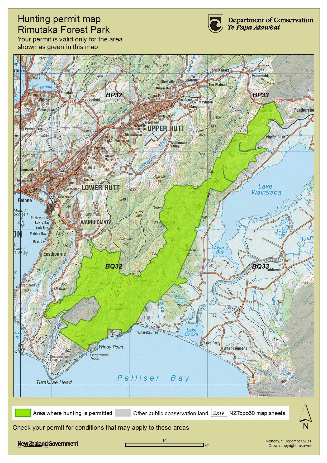
This should clear things up
http://www.doc.govt.nz/documents/par...wellington.pdf
then scroll to page 3
Hunting or discharge of firearms is not permitted in the Catchpool Valley, Landcare Research block, the Orongorongo Valley within 200 m of the edge of the river-bed and within 200 m of the Orongorongo Track (refer to the map for the ‘no hunting area’)
depending on how you interpret it, can still 'walk' throug the area with an unloaded firearm
Similar Threads
-
Goats/pigs in National Park
By Beavis in forum HuntingReplies: 3Last Post: 30-07-2012, 07:17 PM -
Hunting Pureora Forest park
By HFWaikato in forum HuntingReplies: 3Last Post: 02-07-2012, 09:03 PM
Tags for this Thread
Welcome to NZ Hunting and Shooting Forums! We see you're new here, or arn't logged in. Create an account, and Login for full access including our FREE BUY and SELL section Register NOW!!


 3Likes
 LinkBack URL
 About LinkBacks


 Reply With Quote


Bookmarks