Welcome guest, is this your first visit? Create Account now to join.
Welcome to the NZ Hunting and Shooting Forums.
Search Forums
User Tag List
+ Reply to Thread
Results 16 to 30 of 32
Thread: On the hoof in the Northern Ruas
Hybrid View
-
05-03-2024, 01:19 PM #1Member

- Join Date
- Oct 2013
- Location
- Napier
- Posts
- 1,612
-
05-03-2024, 03:37 PM #2
Thanks for the correction BRADS..... good to know my memory is still operating at its usual level

The last time I was in Broome Hut before it was pulled out, was on a weekend territorials exercise and we had 4 or 5 Land Rovers stuck down in the dip by the hut unable to climb back up the papa track
Last edited by NIMROD; 05-03-2024 at 03:43 PM.
-
04-03-2024, 08:27 PM #3Member

- Join Date
- Jul 2014
- Location
- BOP
- Posts
- 4,068
Some awesome country you travelled through , well written story, loved it.
-
04-03-2024, 10:08 PM #4Member

- Join Date
- Dec 2011
- Location
- Southern Alps
- Posts
- 4,884
Thats some write up,good stuff.
-
05-03-2024, 08:39 AM #5Member

- Join Date
- Jul 2020
- Location
- Central North Island
- Posts
- 5,277
Yeah, my memory said it was on the southern side of that wee stream that Barlow hut is by, above the Makaroro river. There was a massive native, about 3 foot in diameter, lying about a dozen feet to the north of the hut. Would have totalled the hut, had it fallen a gnats cock the other way. Have a photo somewhere...

-
05-03-2024, 10:18 AM #6Member

- Join Date
- Dec 2019
- Location
- Okawa Hawkes Bay
- Posts
- 3,177
Greetings @XR500 and all,
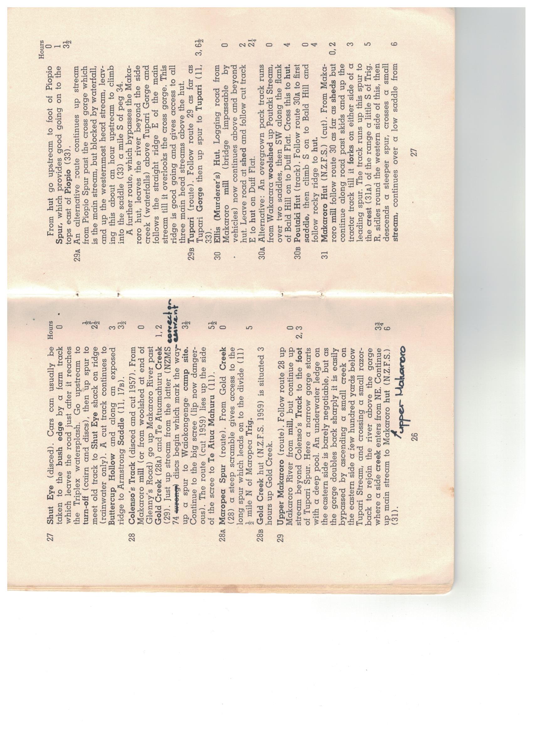
The Makaroro has changed considerably has changed considerably since my first trip in the late 1960's. Centre Makaroro Hut was just to the North of the stream mentioned above and there was a wire bridge connecting to a route to the Parks Peak track. The river bed was considerably lower than now. A major storm in the mid 1970's (possibly Cyclone Alison) deposited vast quantities of gravel in the lower Makaroro reaches covering all of the bush benches. The centre of the wire bridge was now barely a metre above the gravel. Norman Elders route guide talked of a barely negotiable pool at the start of a gorge 30 minutes above the hut and gave directions of how to get around it. On a trip in the late 1970's we were still looking for the pool when we got to Upper Makaroro Hut.
Regards Grandpamac.
-
05-03-2024, 10:46 AM #7Member

- Join Date
- Dec 2019
- Location
- Okawa Hawkes Bay
- Posts
- 3,177


Greetings,
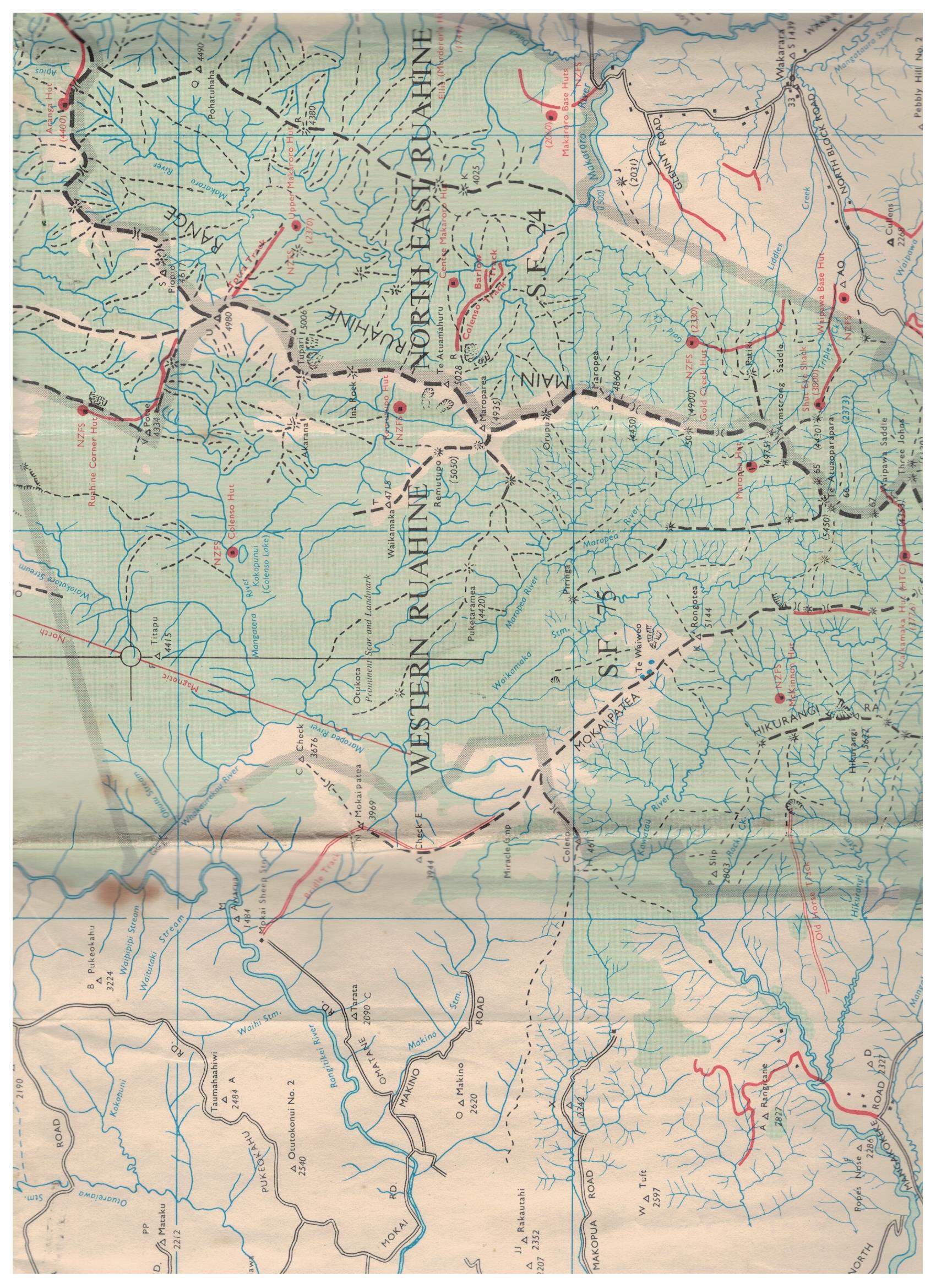
Here are some scans of Elders Route Guide and NZMS74. all we had to go on in the late 1960's.
GPM.
-
05-03-2024, 11:06 AM #8Member

- Join Date
- Jul 2020
- Location
- Central North Island
- Posts
- 5,277
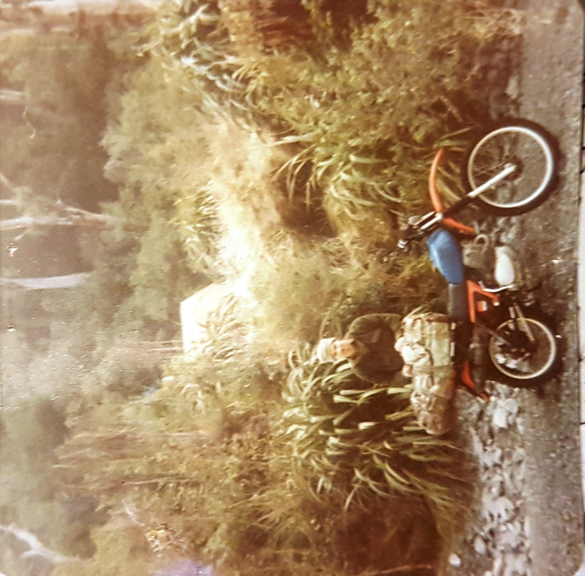
Thanks for that @grandpamac. Yes, that route up the spur opposite the hut up to Parks Peak was a doozy for all the big fat possums we got on cyanide. Too frequently we would come around the corner and think we had poisoned someone's dog...to find it was a big buck possum. The damage to the riverbed was very evident in 1979/1980. Actually made the trip in on the XR500 rather easy....till the wintertime waterlevel rose, and the poor bike needed a snorkle and Vaseline smeared all over the electrics

-
05-03-2024, 01:33 PM #9
-
05-03-2024, 02:30 PM #10
-
06-03-2024, 10:13 AM #11Member

- Join Date
- Feb 2012
- Location
- Stratford
- Posts
- 84
-
06-03-2024, 12:25 PM #12Member

- Join Date
- Mar 2017
- Location
- HB
- Posts
- 440
Just wanted to say I’m enjoying the history in these replies.
-
06-03-2024, 03:59 PM #13
-
06-03-2024, 03:45 PM #14Member

- Join Date
- Dec 2019
- Location
- Okawa Hawkes Bay
- Posts
- 3,177
NZMS74 Oops more later
-
06-03-2024, 04:31 PM #15Member

- Join Date
- Dec 2019
- Location
- Okawa Hawkes Bay
- Posts
- 3,177
Greetings,
In the bottom of my map drawers I found a copy of an old Wakarara N133 map from 1953. It shows some of the detail from the early NZMS 74 map plus some vegetation and topographical detail. Only Shute's and Ellis huts still exist. Some huts carry the names of current huts but these have been replaced over time. There are no huts in the Makaroro catchment and only two tracks, Colenso and Barlow, are shown. That is a lot of change for 70 years.
GPM.
Similar Threads
-
Hello from northern canada
By bearfighter in forum IntroductionsReplies: 12Last Post: 10-02-2024, 06:21 AM -
Hunt the northern tararuas
By Adh in forum HuntingReplies: 9Last Post: 14-12-2023, 10:17 PM -
Northern Newbie
By Ratherbe in forum IntroductionsReplies: 7Last Post: 22-01-2021, 08:53 AM -
Northern Ruahines
By karlos in forum HuntingReplies: 32Last Post: 12-04-2018, 06:24 PM -
Greetings from Northern California!
By summitdogracing in forum IntroductionsReplies: 19Last Post: 15-05-2015, 05:13 AM
Tags for this Thread
Welcome to NZ Hunting and Shooting Forums! We see you're new here, or arn't logged in. Create an account, and Login for full access including our FREE BUY and SELL section Register NOW!!


 70Likes
 LinkBack URL
 About LinkBacks


 Reply With Quote


Bookmarks