Just noticed it does not have any ozzy maps. I just downloaded it free? Is that a cheap version? I could not find another. Got the whole west coast and otago downloaded so I am sussed. Keen to see how it works at home in the scrub.
Welcome guest, is this your first visit? Create Account now to join.
Welcome to the NZ Hunting and Shooting Forums.
Search Forums
User Tag List
+ Reply to Thread
Results 16 to 30 of 78
Thread: Garmin Monterra GPS
-
15-12-2013, 01:08 PM #16Do what ya want! Ya will anyway.
-
-
15-12-2013, 02:10 PM #17
-
15-12-2013, 02:15 PM #18
-
15-12-2013, 02:17 PM #19
-
15-12-2013, 02:54 PM #20
I feel cornered
 Do what ya want! Ya will anyway.
-
15-12-2013, 02:57 PM #21Member

- Join Date
- Aug 2013
- Location
- Christchurch
- Posts
- 449
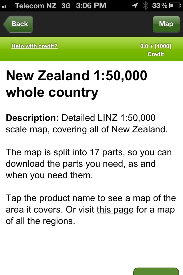
The Topo 250 you can get free. So those are the 1:250,000 topo maps for the whole of NZ. Still pretty good. There's a big difference with the 1:50,000 ones though. 5 times the detail basically, and you can zoom in heaps.
If you pay for the app you get something like 1,000 credits, which can be used to buy individual tiles of areas. You can then buy individual tiles at 1:50,000 in NZ, or pay the $30-40 for the whole country. I did that and have kept my 1,000 credits for if I ever go overseas or when Aus gets added.
-
15-12-2013, 03:08 PM #22
-
15-12-2013, 03:11 PM #23Member

- Join Date
- Aug 2013
- Location
- Christchurch
- Posts
- 449
That's the one! Awesome maps. The detail without having to carry big unwieldy bits of paper around.
There's always an argument for taking a backup in case your phone breaks or something though.
-
15-12-2013, 03:23 PM #24
I downloaded the whole West Coast and Otago for around $6. They are 1:50,000 maps. I downloaded the initial view ranger app for free so was worried it was a cheap version. Looks good so far.
Last edited by R93; 15-12-2013 at 03:31 PM.
Do what ya want! Ya will anyway.
-
15-12-2013, 03:30 PM #25

Screenshot of the map quality. 1:50000
Cheers for the heads up on this Brads.
If it works where I will use it most, I will be stoked.
Sent from my iPhone using TapatalkDo what ya want! Ya will anyway.
-
15-12-2013, 04:11 PM #26Member

- Join Date
- Aug 2013
- Location
- Christchurch
- Posts
- 449
Yup, you're onto it. And see the bar at the bottom? You can zoom in so much on the 1:50,000 maps so as to make that a 200m bar.
I also use Google Earth on my phone and take a few screenshots of the areas i'll be going, so you can even see the terrain, etc. Really handy and again all stored on the marvelous phone!
-
15-12-2013, 04:57 PM #27AB Precision

- Join Date
- Dec 2011
- Location
- Nelson
- Posts
- 2,209
Still means taking the phone and putting a lot of trust in it. I have back country navigator good for playing wouldn't use it in the bush, I'll let you know how it is soon just got one as well have to keep up with the gear whore lol
Sent from my GT-I9300T using Tapatalk
-
15-12-2013, 05:55 PM #28Member

- Join Date
- Aug 2013
- Location
- Christchurch
- Posts
- 449
True, but it's either trust in a GPS or trust in a phone. GPS are more durable and you can get water proof ones, etc, but it's probably pretty close with some of the phone cases around now. I figure as long as you have a good case, and a paper or laminated backup map, and a PLB for when the shit really hits the fan then you're pretty well covered.
Whenever I go with my wife we are just going to keep 1 of the phones turned off in bombproof protection in the pack as well....so we'll have multiple backups.
-
15-12-2013, 08:03 PM #29AB Precision

- Join Date
- Dec 2011
- Location
- Nelson
- Posts
- 2,209
That's fair call, Modern day hunter I spose you have to stuff up really bad to get lost an need one, only time I use them is coming off the hill tahr hunting on the coast in the dark to avoid getting bluffed all the time...................................where im lazy an keep going down I have Sam an Blair to say left, straight or ok fuck crank that bad boy out here gets nasty as shit

I wouldn't really mind if I didn't have one but like to keep shit down in the back pack an hunt simple the way it should be without a gadget for this gadget for that end up spending more time on technology in the hills then what you do getting back to the basics......................and they don't find you the animals
-
16-12-2013, 11:27 AM #30
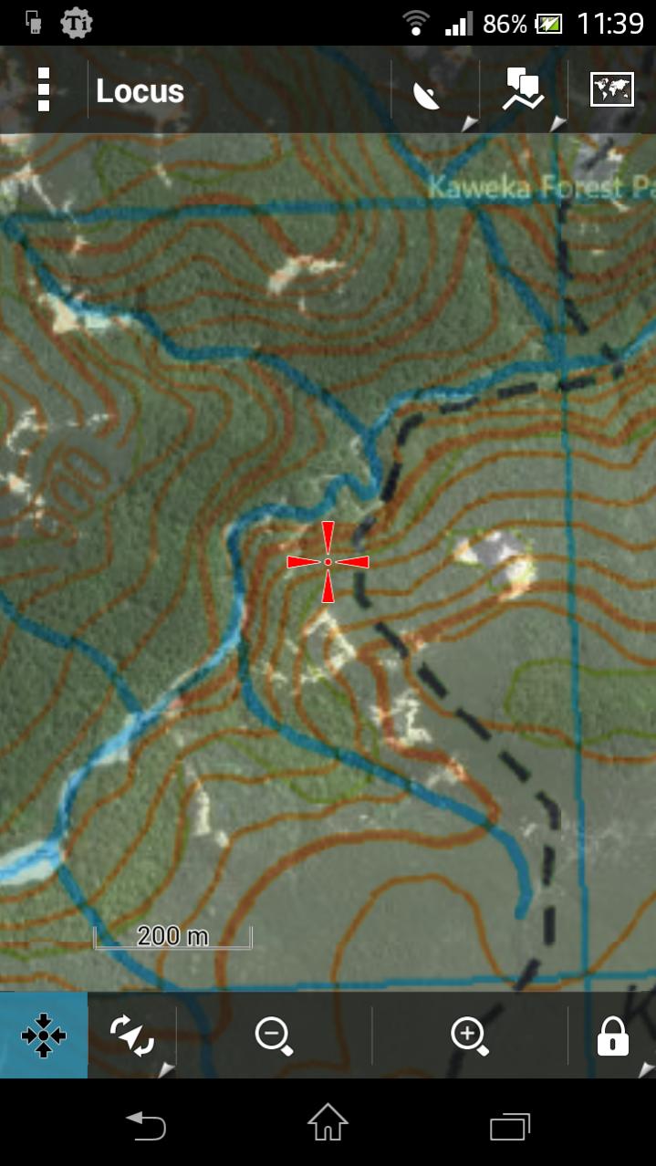
Some other apps to check out: Locus, Back Country Navigator, Maverick. I use Locus Pro myself, has offline maps, topo shading and map overlays (eg overlay Sat map on topo) as well as every other feature you'd need. Developer is responsive too, I requested the NZtopo maps to be added as one of the online options and he added it.
Full NZTopo50 maps are available for free (my favorite price) I just use the PC program "Mobile Atlas Creator" to make the offline maps I want - NZTopo50, sat, street or whatever. Copy the file to my phone - easy as.

Heres an example of Topo map with Sat overlay (you can adjust the transparancy to suit)Last edited by SIKAHUNTER; 16-12-2013 at 11:49 AM.
Similar Threads
-
garmin 62s
By nork1122 in forum Gear and EquipmentReplies: 9Last Post: 15-07-2013, 04:08 PM -
garmin 62s, which sd card?
By foxhound in forum Gear and EquipmentReplies: 0Last Post: 09-03-2013, 06:19 PM
Tags for this Thread
Welcome to NZ Hunting and Shooting Forums! We see you're new here, or arn't logged in. Create an account, and Login for full access including our FREE BUY and SELL section Register NOW!!


 20Likes
 LinkBack URL
 About LinkBacks


 Reply With Quote


Bookmarks