

 20Likes
 LinkBack URL
 About LinkBacks
Yeah mate has it for his Oregon 450. From memory its $50NZ per year for PC. You then load selected areas onto your device and once done its there for ever. So a device with good internal mem is going to be able to take more.Originally Posted by SIKAHUNTER

Welcome guest, is this your first visit? Create Account now to join.
Welcome to the NZ Hunting and Shooting Forums.
Search Forums


User Tag List
+ Reply to Thread
Results 46 to 60 of 78
Thread: Garmin Monterra GPS
Hybrid View
-
17-12-2013, 11:23 AM #1Codswallop


- Join Date
- Feb 2013
- Location
- The Hill
- Posts
- 23,565
-
16-12-2013, 01:26 PM #2Member

- Join Date
- Feb 2012
- Location
- Westland NZ
- Posts
- 16,102
That satellite overlay would be the shit!!! I only seem to use a GPS for wallow and track marking or if ever in flat bush somewhere new. But I do appreciate all the extras you can get.
 Do what ya want! Ya will anyway.
-
16-12-2013, 01:33 PM #3Member
- Join Date
- Aug 2012
- Location
- Christchurch
- Posts
- 4,626
Ha ha to right munsey it's quite bad really how far behind a handheld gps is when compared to smart phones, sure they are a bit more rugged but screen resolution and sensitivity is pretty much like a 5 year old phone... I do like the buddy location and message feature on the rhino tho..
Munsey likes this.
-
16-12-2013, 01:50 PM #4Codswallop
- Join Date
- Feb 2013
- Location
- The Hill
- Posts
- 23,565
Screen resolution and processing speed on my 650 is pretty sweet. Has a 8 megapixel camera, led flash that doubles as a light. I dont know what it is but I just cant rely on my iPhone for this stuff. To fragile? Originally Posted by PerazziSC3
I think the smartphone companies should start building purpose built GPS units and drive the tech up and cost down.
-
16-12-2013, 01:56 PM #5Member
- Join Date
- Aug 2012
- Location
- Christchurch
- Posts
- 4,626
What model Gibo? I guess if I was to compare a 62s specs to a smart phone (62s normally $500 ish) I could get everything the 62 has plus a half decent camera and 10x better screen not to mention apps ect in a $80 smart phone....
The selling point for me on the rhino is the radio/message feature...
Now what I would buy would be one of these monterras, with a radio feature and a plb all in one unit. That would be an awesome bit of kit
-
16-12-2013, 02:26 PM #6Codswallop
- Join Date
- Feb 2013
- Location
- The Hill
- Posts
- 23,565
This one. Originally Posted by PerazziSC3
https://buy.garmin.com/en-US/US/on-t...rod113520.html
-
16-12-2013, 02:16 PM #7GSP Mad

- Join Date
- Mar 2012
- Location
- Christchurch
- Posts
- 5,237
What's the "buddy feature " on view ranger ?
Rule 7: Avoid alcohol and drugs when handling firearms
-
16-12-2013, 03:12 PM #8Member
- Join Date
- Aug 2013
- Location
- Christchurch
- Posts
- 449
You can check where friends have been and stuff like that if you both allow it. Don't believe it's live though - or not unless you have cell reception. Could come in handy though if you wanted to tell a mate about a real good spot, etc. Originally Posted by Munsey
I nearly bought a top of the range dedicated GPS but then just thought i'd check what sort of apps are available. There are far too many reports of the GPS on top of the line phones outperforming the dedicated GPS devices. To me the only advantage is the durability or ruggedness, as mentioned. But I think that can be negated.
I'm glad i've limited my devices, but still have to carry phone, binos, rangefinder, plb. Now if someone could come up with a smart phone that was also a PLB and maybe even a rangefinder.....
-
17-12-2013, 11:11 AM #9Member
- Join Date
- Aug 2012
- Location
- Christchurch
- Posts
- 4,626
Legend mate
-
17-12-2013, 11:49 AM #10Muppets Inc.

- Join Date
- Jun 2012
- Location
- Napier
- Posts
- 303
I find Microsoft's Bing Sat pics to be of a better quality than Google.
-
17-12-2013, 12:02 PM #11Codswallop
- Join Date
- Feb 2013
- Location
- The Hill
- Posts
- 23,565
Shit yes, thanks mate thats way clearer to look at Originally Posted by SIKAHUNTER
-
17-12-2013, 12:22 PM #12Muppets Inc.
- Join Date
- Jun 2012
- Location
- Napier
- Posts
- 303
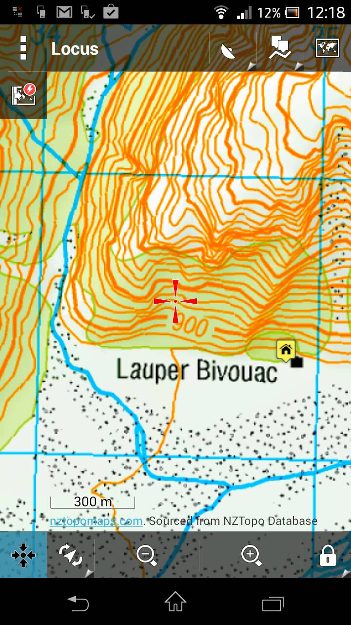
@MattyP a South Island example might make it more obvious
-
17-12-2013, 12:28 PM #13Muppets Inc.
- Join Date
- Jun 2012
- Location
- Napier
- Posts
- 303
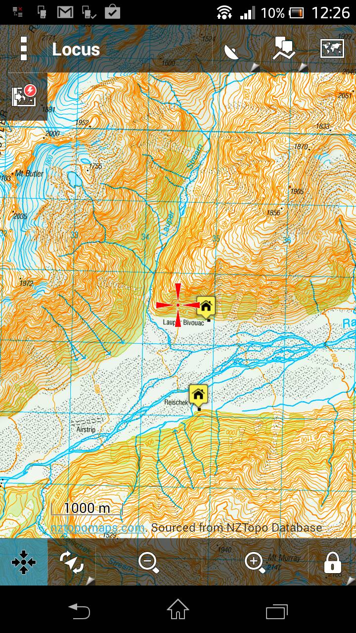
And one more for good measure, this time zoomed out a bit. The actual picture on-screen is clearer than the attached pic, I guess it's compressed somewhere along the way.
As for DOC boundaries I know you can download the DOC boundaries for the entire country on koordinates website but it is a huge ass csv file that'd need converting to kml. Shame you can't just download the area you want as the website gives you the option to download as a.kml file but the entire country is too large apparently. You'd need to cut and convert the areas of interest from the csv file.Last edited by SIKAHUNTER; 17-12-2013 at 12:39 PM.
-
17-12-2013, 03:00 PM #14Member
- Join Date
- Aug 2013
- Location
- Christchurch
- Posts
- 449
Now that's more like it! Definitely look like 1:50,000 now. I wonder what maps they are, as they look different to the LINZ ones that Viewranger uses. What are they called? Originally Posted by SIKAHUNTER
Sounds like a hassle to add the DOC boundaries, I guess i'll just stick to my basic method of drawing them in by having Viewranger open and referencing against the DOC ones.
DOC could definitely make life easier in terms of availability of information. Yes, you can find it on their site, but the site is a total shit fight. It took me quite a while to find the maps with approved hunting areas shaded in, and it still does, and i'm reasonably tech savvy. Not to mention some maps cut off and the hunting area goes off the page, and I assume you have to try and find the block next to it and then put those maps side by side to figure it all out. I haven't had to do that yet, thank fuck. It's no wonder that people get caught out in the wrong areas if you ask me!
-
17-12-2013, 03:36 PM #15Muppets Inc.
- Join Date
- Jun 2012
- Location
- Napier
- Posts
- 303
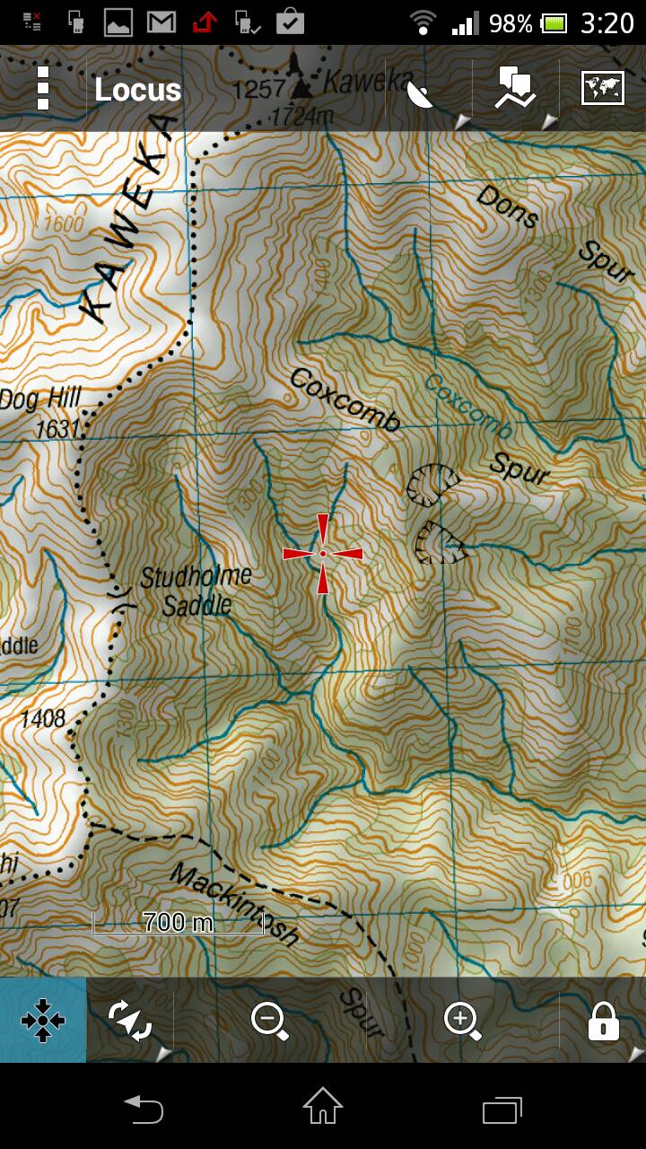
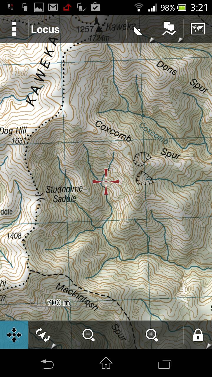
They are from the NZtopomaps database. Might look different because you can select different view options for the same map, eg shading on/off, normal/low/high contrast on/off, night mode or layers on/off. Here's some examples of the same map but with different options enabled. Originally Posted by MattyP
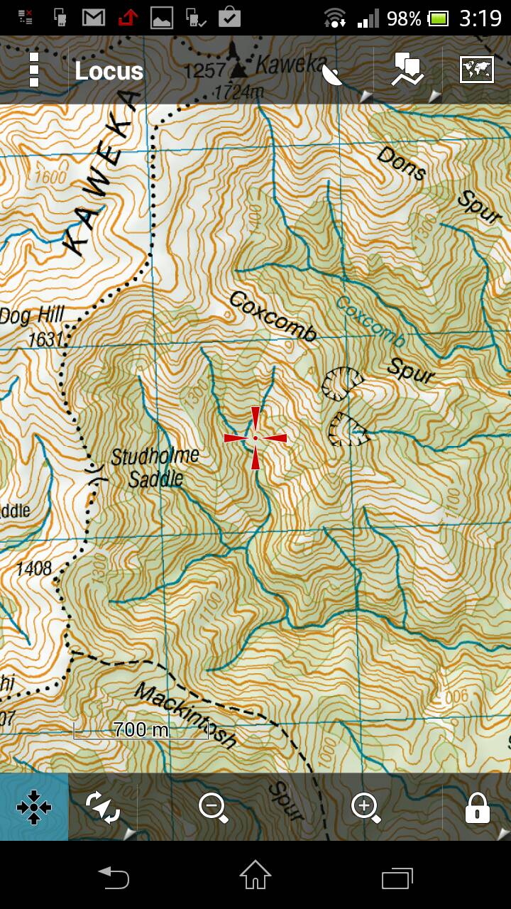
Standard contrast, no shading
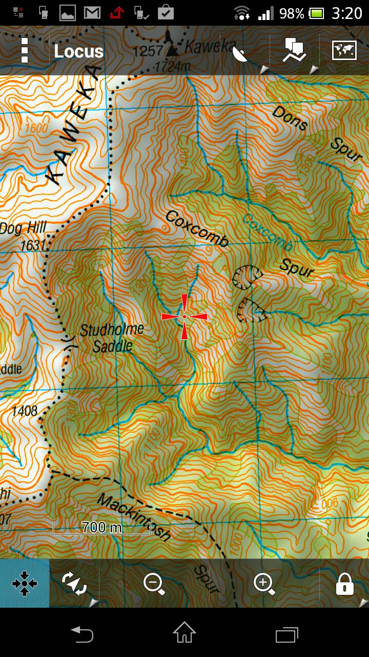
High contrast with shading
Standard contrast with shading
Low contrast with shading
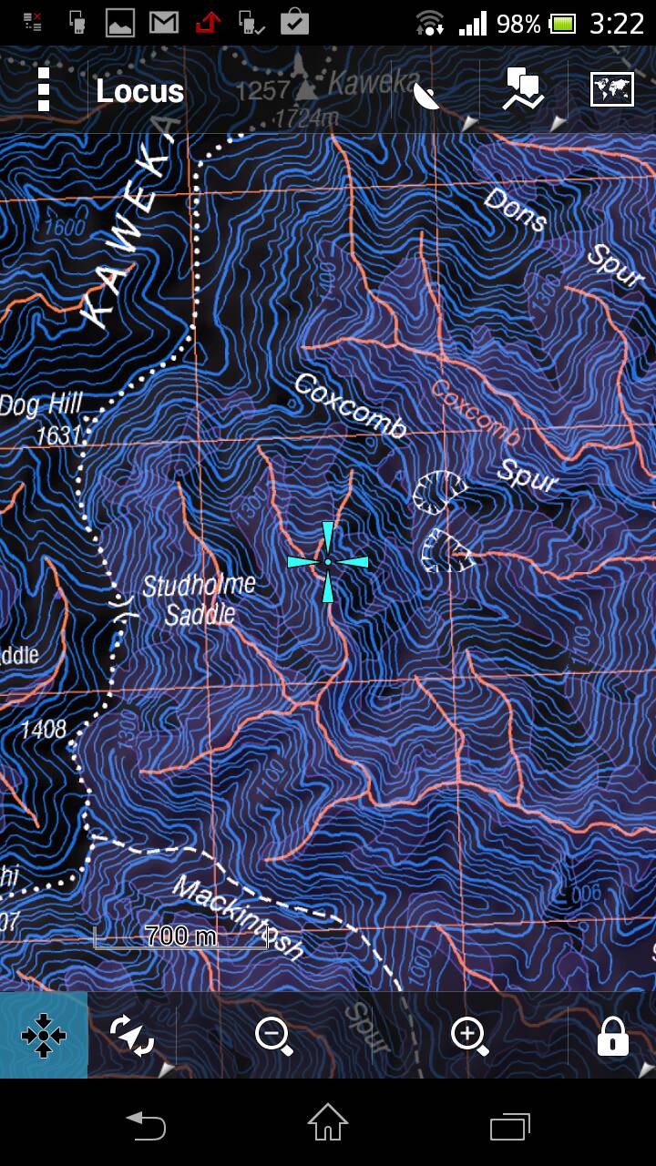
Night mode no shading ;p
I reckon the shading makes the maps almost look 3D.


 Reply With Quote
Similar Threads
-
garmin 62s
By nork1122 in forum Gear and EquipmentReplies: 9Last Post: 15-07-2013, 04:08 PM -
garmin 62s, which sd card?
By foxhound in forum Gear and EquipmentReplies: 0Last Post: 09-03-2013, 06:19 PM
Tags for this Thread
- 260,
- 300,
- 5000,
- accurate,
- adventure,
- app,
- atlas,
- ballistics,
- bucks,
- buy,
- camera,
- canopy,
- case,
- cheap,
- coast,
- day trip,
- deer,
- device,
- farmer,
- garmin,
- gear,
- gps,
- handheld,
- information,
- iphone,
- kawekas,
- legend,
- loads,
- lost,
- maps,
- offline,
- pack,
- packs,
- pants,
- permits,
- phone,
- plb,
- r93,
- radio,
- rangefinder,
- ranger,
- ranges,
- receiver,
- rino,
- rust,
- satellite,
- sony,
- south island,
- tahr hunting,
- tents,
- test,
- top,
- topo maps,
- trip,
- turn,
- usa,
- water proof,
- waterproof,
- west coast
 Posting Permissions
- You may not post new threads
- You may not post replies
- You may not post attachments
- You may not edit your posts
Welcome to NZ Hunting and Shooting Forums! We see you're new here, or arn't logged in. Create an account, and Login for full access including our FREE BUY and SELL section Register NOW!!
All times are GMT +13. The time now is 12:01 PM.

Bookmarks